Geopositioning
The mobile application also enables you to track the geographical location of individuals as they navigate a path using it. As a result, the BPS application administrator gains valuable insights into the precise location of a specific individual.
How it works?
The geographical location information of the mobile application user is collected as they traverse a correctly configured path. The user intending to traverse it must grant the mobile application the required permissions to retrieve information about the device location, otherwise, they will not be able to traverse.
It is worth noting that while the functionality can also be used in Portal opened on a PC, utilizing it on a mobile device ensures more precise and reliable results.
Where the location is stored?
Information about the user's location is stored in the instance history. This data can only be viewed by individuals authorized to display the instance history in admin mode (after clicking the gear icon).
The geopositioning button is located in the upper right corner of the window which appears after clicking the path icon.
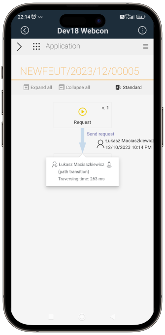
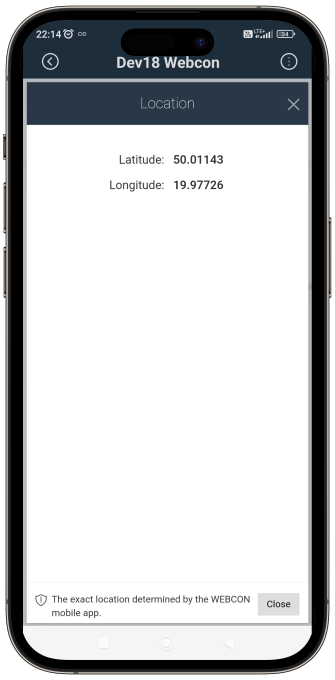
Clicking this button opens a Google map with the user's geographical coordinates, allowing you to easily determine their location at the time of traversing a path.
How to configure?
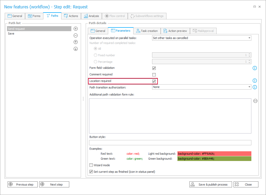
To utilize this functionality, navigate to the specific path settings in the Designer Studio. Within the Parameters tab, you'll find the Location required checkbox. Enabling this option ensures that path transition is only possible after collecting location information.
Geopositioning in quick paths and mass actions
In scenarios where you transit a path for multiple instances simultaneously through mass actions or quick paths, the system requires sending location data only once.
Conversely, in a scenario where the mentioned functionality has not been enabled on a parent workflow path, but is enabled on the subworkflow path, sharing this information will be mandatory.
Context variables
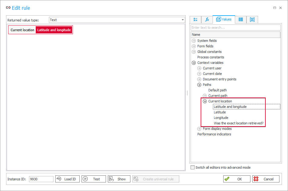
The data on user location at the time of transiting a path is available in the context variables of business rules in the Current Location node of the expression editor. There are four variables available:
- {CURRENT_LOCATION} – information about the geographical longitude and latitude, the return value is in the form:
[Latitude], [Longitude], e.g. 50.005938, 19.8766193 - {CURRENT_LOCATION_LATITUDE} – information about geographical latitude only,
- {CURRENT_LOCATION_LONGITUDE} – information about geographical longitude only,
- {CURRENT_LOCATION_TRUSTED} – information indicating whether the precise location has been retrieved using the GPS device. The
TRUEvalue means that the location was obtained using a mobile application that has mechanisms to protect against attempts to manipulate the location (e.g. using the application to simulate the location). The valueFALSEmeans that the location was obtained based on data from the browser or the user did not consent to access to the exact location.
To retrieve location data using those variables, you must enable the functionality in the path configuration (the Parameters tab → the Location required checkbox) and use them within the context of a path transition executed by a user (automatic transition executed by the Service will not result in collecting this data).
In addition to the previously mentioned variables available for business rules, users can also utilize the {CURRENT LOCATION} variable in form rules. This variable allows you to retrieve GPS location (geographical longitude and latitude) directly from the form without the need to transit a path.